About Northeast
Covering an area of 2,62,230 sqk.m touching the international boundary sharing with China, Bhutan, Nepal, Myanmar and Bangladesh, the remotest corner of India the North East Region is a magical Tourism Hub. It is atreasure yet to be discover a lot. Comprises of eight states- The Assam, Arunachal Pradesh, Maghalaya, Monipur, Mizoram, Nagaland, Tripura and Sikkim –the North East India is a rich treasure trove of Culture, heritage and Nature. A splendid potentiality of Tourism Products includes of Topography to Community, Flora to Fauna and Lifestyles to Traditional heritage- North east India is not only a fabulous destination for vacation, yet the magical excitement to explore the untouched nature and the enchanting ambience with awesome culture and gorgeous heritage feelseveryone who visits North East an experience in ecstasy ever to be remembered. Because, one who visits this amazing mystique, finds reasons of reasons to fall in Love with India’s North East. That’s why it’s true if someone travel to India's North East…..
ASSAM: the land of Blue & Green Patchwork
Latitude 26.244156° N
Longitude: 92.537842° E
Time zone: IST (UTC +05.30)
Climate: Tropical Monsoon Rain Forest
Temp: Max 35 – 40 Celsius, Min 15- 25
Area:78,438 sq k.m.
Official Language: Assamese
Other Languages: Hindi, English, Local dialect of the tribal communities
Community, Culture & Heritage
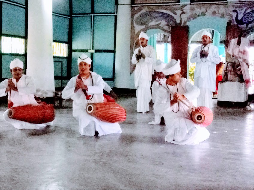
Majuli:
The only riverine islandin the Worldlocated amidst the flowing legend the Mighty Brahmaputra is famous for the Xatra institution andXatriya form of Art & Culture initiated by Saint Srimanta Sankardeva in the 15th century A.D.
Besides to the unique heritage, surrounded by numerous Water bodies Majuli is a Birders' paradise.
Situated at a distance of around 350 KM away from the Gateway of North East- Guwahati, Majuli Ride on the Ferries or Motor Boat Majuli can be reached in an one hour exciting journey over the flowing legend mighty Brahmaputra enjoying the amazing panorama and looking over the hide & seek of River Dolphin in the River Water.

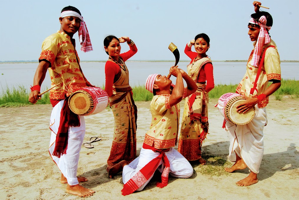
Tribal Art, Culture and the lifestyles:
Explore the magnificence of the amazing tribes of Assam and experience the ethnicity of riverine tribe- the Mishing, Hill tribe the Karbi, Colourful Weavings of the Bodo, Cultures of the Dewri, Magnificence of the Tai Phake, Heritage of the Dimasa &Joys of the others...
Wild Life
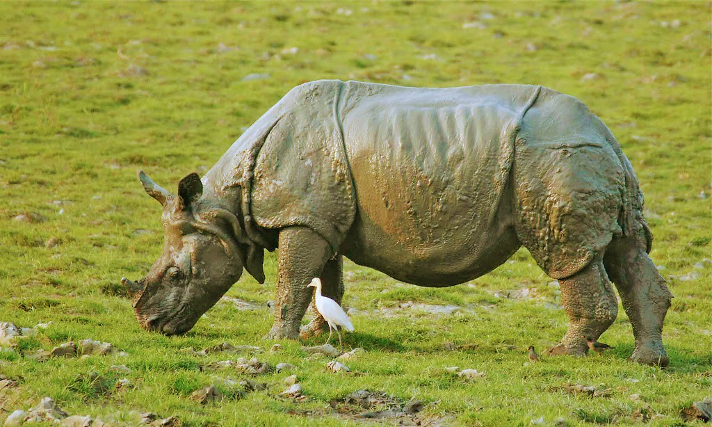
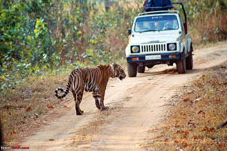
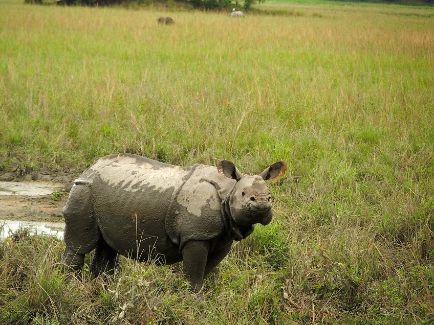
Kaziranga National Park:
Home to the World fame One Horned Rhinoceros Kaziranga is the National Park covering an area of430 Sq Km Located at a distance of 170 Km Kaziranga National Park has the population of 2,413 Rhino, 1,945 Asiatic Elephant, 1,660 Wild Water Buffalo, 468 of endangered Swamp Dear, 118 Royal Bengal Tiger according to latest census report includes of the 55 mammalian species and almost 478 species of Birds (both migratory and residential).
Manas National Park:
Bordering to Bhutan and India in Assam the spectacular Manah National Park is a place of perfect wilderness ever to experience. Located on the foothills of the Himalaya at a distance of 138 Km from Guwahati, covering an area of 460Sq Km Manah is a Bio reserve was listed in World Heritage Site. Home to the both Grassland Biomes and Forest Biomes, Manas has over 50 Species of Mammala,380 Species of Avian Life and 540 Species of Floura.
Pabitora Wild Life Sanctuary:
Located at a distance of 45 Km from Guwahati Pabitora is a Wild life Sanctuary covering an area of 38.8 Sq Kmandknown for thehighest density of Rhino population. Besides, Pabitora is a major routes of the winter migratory Birds.
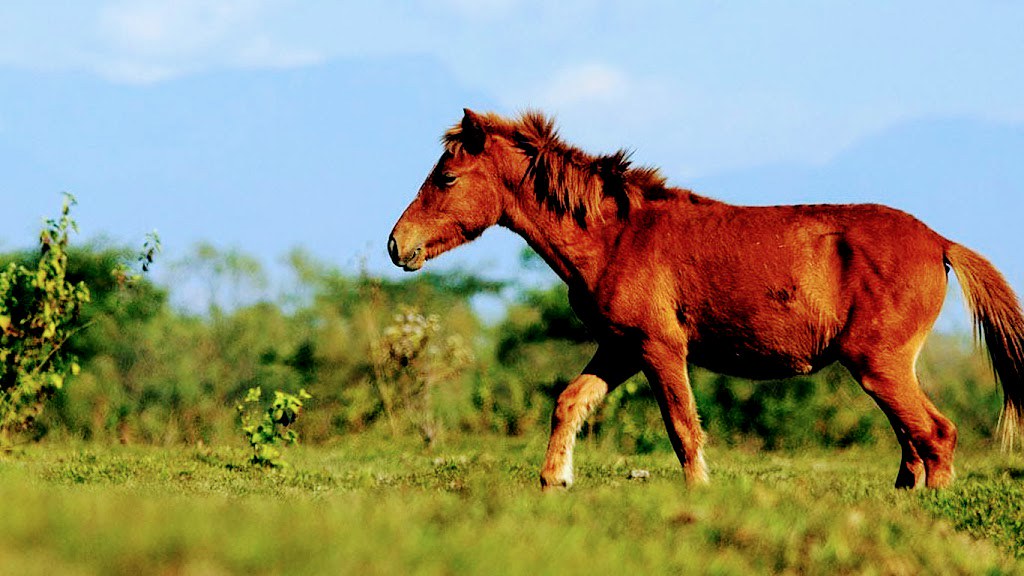
Dibru Saikhowa National Park:
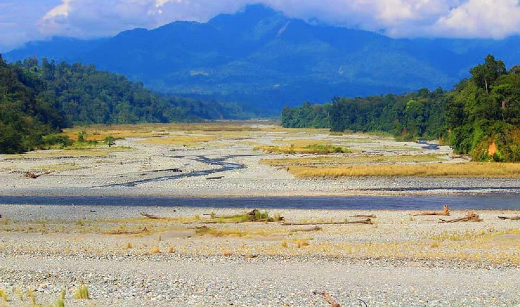
Located in the Upper Assam by the side of the mighty Brahmaputra and Dibru river at a distance of95 Km from another major city Dibrugarh, Dibru saikhowa is the home of the Feral Horses apart from other wild animals covering an area of 425 Sq Km.
Greenland of Tea & Golf
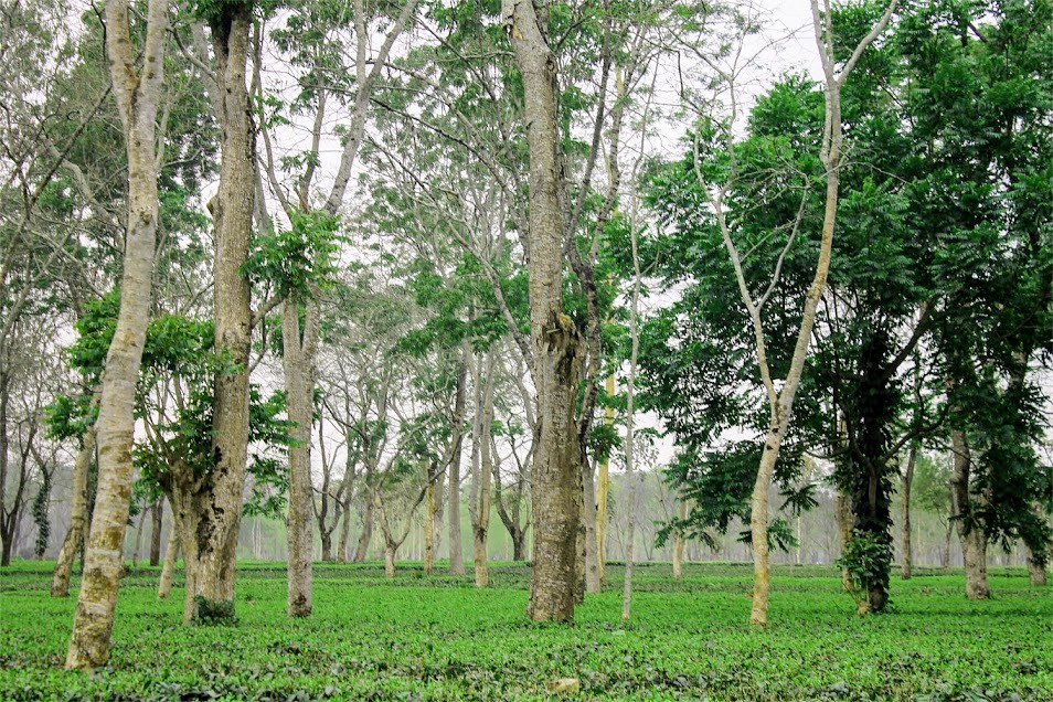
Assam is known for Tea in the World. Having more than 800 numbers of large tea gardens and simultaneously the Golf courses established by the British India, a visit to this Tea growing region is totally worth it. Experiencing these heritage colonial Tea Bungalows&Tea Estates experiencing the process of Tea manufacturing amidst the joys of colorful folk cultures of the Tea Community with a round of Golf is the most idyllic way for holidaying in Assam.
Religious, Archaeological & Research
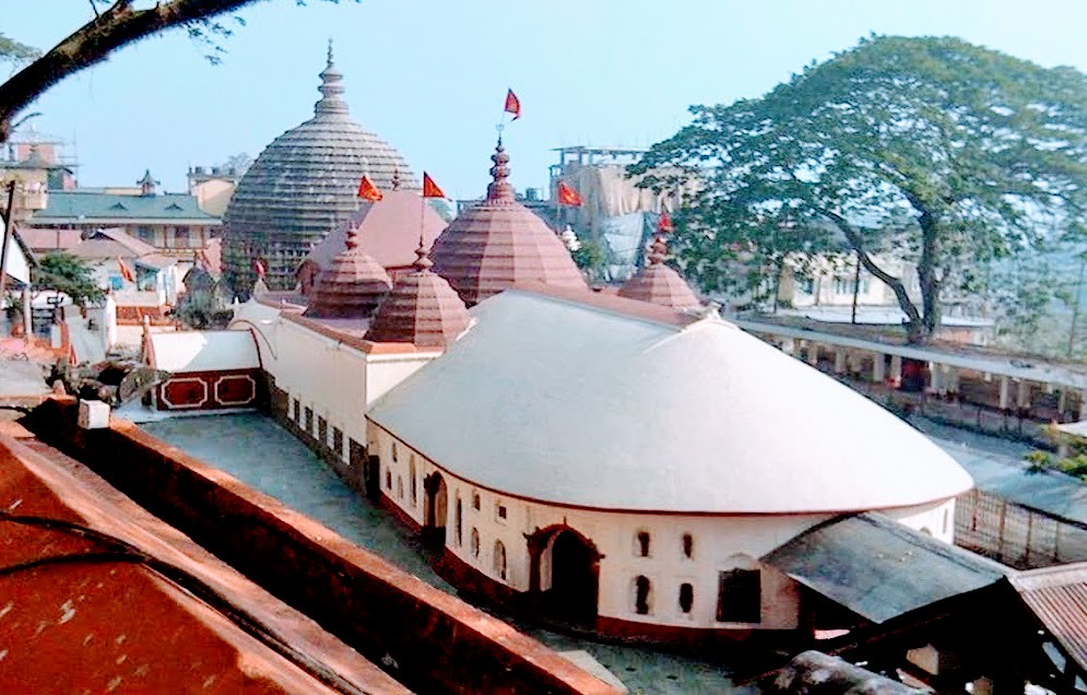
Mother Goddess Kamakhya Temple:
Situated at the top of Nilachal Hill in Guwahati Kamakhya is the amongst51 Shakti Pithas of India. With the hemispherical dome and the Sanctum shaped of a Yoni-the female genital filled with water all the time, the temple is a holy shrine and most important center for pilgrimage Tourism apart from source for research.
Apart to that Basisthashram existed since datesback to the Vedic age, from11th - 12th centuries old relics at the archaeological sites in Madan Kamdeva to the Navagraha temple atop in the Chitrachal hillock charms every visitors.
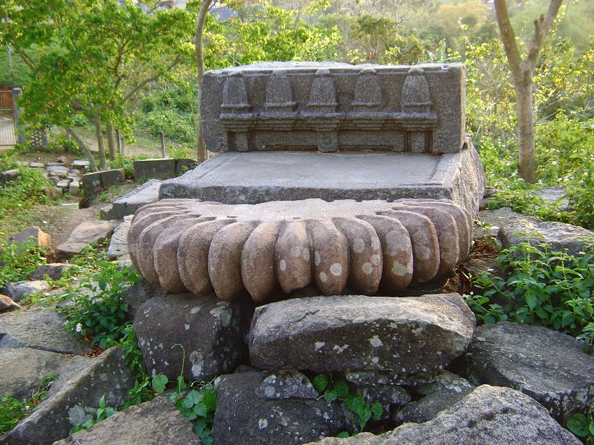
Da Parbatia Doorframe & Bamuni Hill :
Located at Tezpurat a distance of 190 Km from Guwahati, Da Parbatia is an ancient monuments with finest sculptural art of Gupta era in the 6th-7th century. The ruins of temple Doorframe is said to be the finest architectural depiction in India. As well as the ruins of the Bamuni Hills speaks of the bygone era till date and a major source of research.
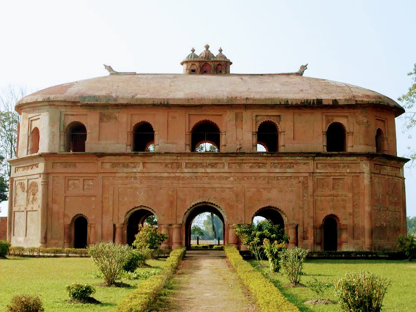
Sibsagar:
Located at a distance of 360 Km from Guwahati and 82 Km from Dibrugarh present Sibsagar town was the ancient capital of the Ahom kingdom who ruled the state for long 600years still bears the testimony of the Kingdom. Known as a place of historic importance Sibsagar still glitters with the old palace, museum, temple and archaeological evidences.
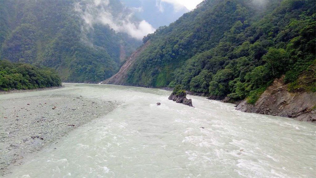
Amazing Brahmaputra
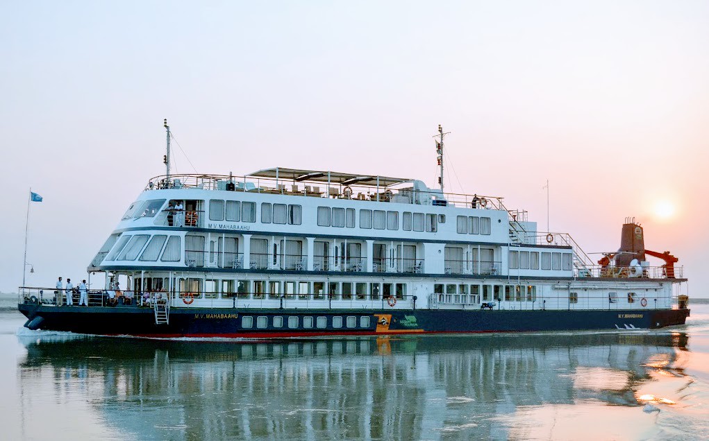
Ride on the Boat (motor boat or Ferry) over the flowing legend the Mighty Brahmaputra enjoying the amazing panorama is an amazing and thrilling adventure for lifetime.
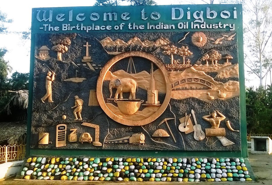
Digboi:
Known as the Oil city located at a distance of 85Km from Dibrugarh Digboi Oil Refinery was started in the year1901 is must to see and the place says till date about the story Dig-Boy-Dig.
Wellness & Yoga
Revive your mind,refresh your life with a new concept of wellness tour at Majuli-a centre for Xatra tradition initiated by saint Xankardeva in the 15th century A.D. and indulge in traditional yoga practices, meditation and healthy organic cuisine amidst the largest riverine island Majuli.
Featured Circuits
Guwahati - Kajiranga - Majuli - Sibsagar - Dibrugarh Dibrugarh - Dibru saikhowa National Park-Namsai - Wakro - Tezu - Roing - Dibrugarh Dibrugarh - Dhemaji - Pasighat - Along - Mechuka Dibrugarh - Digboi - Margherita - Tinsukia - Dibrugarh Guwahati - Manah - Tezpur - Kaziranga - Shillong Guwahati - Nameri - Dirang - Bomdila - Tawang Guwahati - Shillong -Cherrapunjee - Mawsynram
ARUNACHAL PRADESH: The Land of the Rising Sun
Latitude: 28°00° N
Longitude: 95° 00° E
Time zone IST (UTC +05.30)
Elevation:13,700 ft at Sella Top ( one of the highest motorable pass)
Climate: Humid Sub tropical to Subtropical highland to Alpine (Climate varies with altitude)
Temp.:Summer 15° to 25° Celsius, Winter 12° to -20° Celsius (Temperature varies with altitude)
Area 83,743 sq km k.m.
Official Language: Hindi, Local Tribal Dialect, English
Community, Culture & Heritage
Magnificence of the geographic locations, beautiful Tribal villages of the ethnic communities like Adis, Mishimis, Apatanis, Monpas, Khamtys, Singphous, etc. & their rich cultural traditions, folks The traditional weavings, crafts & ornaments and the colorful festivals and serene atmosphere.
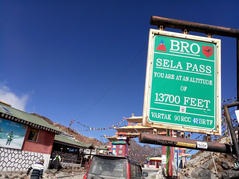
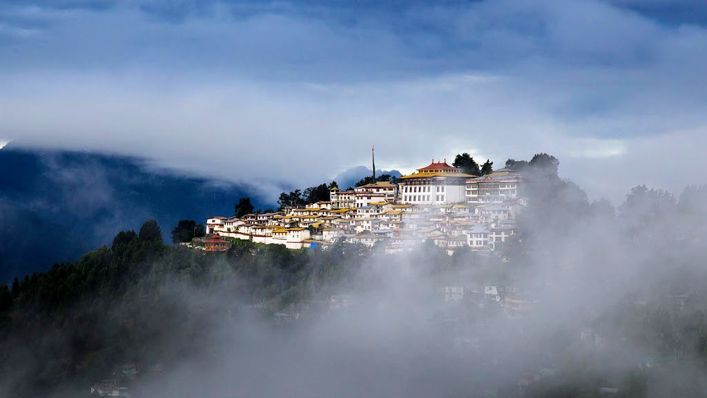
Monastic Tour, Tawang & Sella Pass:
Known as the Switzerland of the East located at the height of 10,000ft above msl Tawang is Worth to visit in Arunachal Pradesh. The Snow clad mountains in the winter, Tawang along with the thrill to cross the high altitude lakes, one of the highest motorable pass-the Selapass at the elevation of 13,700feet above, tour over the War memories of the Indo-China War in 1962, the Asia’s second largest monastery, Awesome Nunneries –the Tawing Monastery, trip to magnificent Bumla & Lumla-the Indo-China Border point are in the bucket list of must see..

Ziro Valley:
Ziro Valley is located at the elevation of 5.500 ft above msl, famous for Wet Rice Cultivation in the Apatani Tribes area of the Arunachal Pradesh.
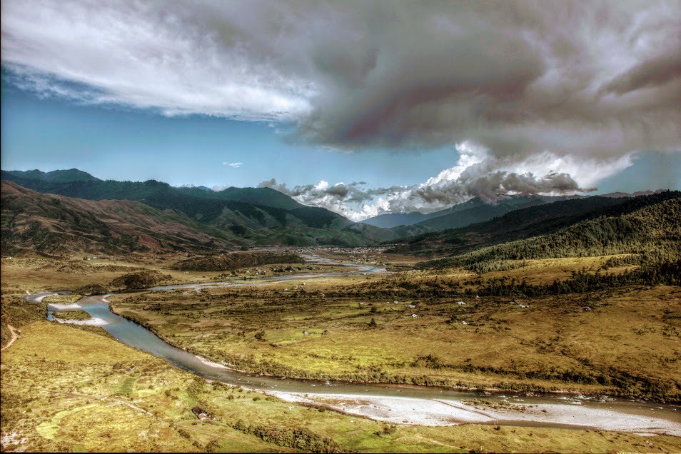
Mechuka - The paradise on Earth:
Located at the height of 6ooo ft above Mechuka is a paradise on Earth in the west Siang District of Arunacha Pradesh. Just 29 Km away to the Mc Mahon line of Indo- China border Mechuka is known as the Forbidden Valley of Arunachal.
Dong:
Dong is a tiny hamlet at a hillock in the easternmost part of India, located in the Anjaw District of Arunachal Pradesh near the confluence of Lohit and Sai ti River overlooking international boundaries of India, Myanmar and China. At the elevation of 4070 ft above this enchanting place is so significant that Dong received first Sun Rays in India in between 3.00 Am to 3.15 AM.
Wildlife in Arunachal Pradesh
Namdapha Wild life sanctuary:
Located in the Changlang Valley Namdapha is famous for the endangered Clouded Leopard, the Snow Leopard and the Red Panda etc, In the Eastern Himalaya Namdapha is one of the richest Bio Diversity hotspot of India.
Eagle Nest Wild Life Sanctuary:
Located in the West Kameng District on the foothills of the Himalayan range Eagle Nest is a Birders paradise and home for rare & endangered animals.
Trekking & Cycling
It is the best to visit and experience the moments in Arunachal Pradesh if there is an adventurous mind and has a feel for a trekking &cycling expedition.Because with the stunning beauty of dawn-lit mountains, smelling orchids varieties, sounds of the torrential rivers, and the ecstasy of the dense forest, the heartwarming greetings of the local tribal peoples amidst the hilly trails it is the perfect choice of diehard trekkers and cyclists in Arunachal.
Featured Circuits:
Guwahati - Bhalukpong - Dirang - Bomdila - Tawang - Zemithang
Guwahati - Bhairabkunda - Khalaktang - Tawang - Bomdiala - Dirang - Bhalukpong - Kaziranga
Guwahati - Pasighat - Along - Menchukha
Guwahati - Ziro - Daporizo - Along - Panging - Pasighat - Dibrugarh
Guwahati - Pasighat - Boleng - Jenging - Tuting - Gelling
Dibrugarh - Namsai - Tezu - Roing - Hunli - Dibang Valley
Dibrugarh - Roing - Mayodiya - Anini
Dibrugarh - Margherita - Miao - Namdapha
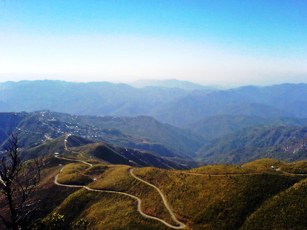
Meghalaya: The Abode of Clouds
Latitude: 25°30° N
Longitude : 91° 00° E
Time zone IST (UTC +05.30)
Elevation 490 feet to 6500 feet
Climate Pleasant and Bracing
Temp. summer 25 -15 celsius
Winter 15- 5 celsius
Area 22,430 sq k.m.
Official Language Khasi, Garo, Hindi, English
Community, Culture & Heritage
Khasi Traditional Villages, Jayantia traditional Villages, Garo Traditional villages, Smit village –the Queen’s traditional village, Nongkrem festival, Shad Suk Mynsiem, Behdeinkhlam, Wangala, Orange & Cherry Blossom festival and so on.
Eco & Nature:
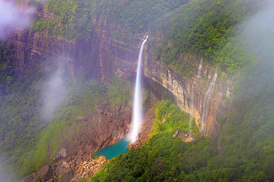
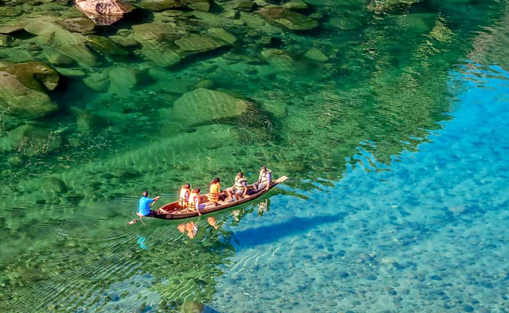
The Eco destinations in the great sacred groves of Meghalaya in East Khasi hills Dist.( Mawphlang sacred grove), Mawlyngnong Village in East Khasi Hills Dist. ( the age old cleanest village of Asia), The Nongkhnum Island in West Khasi Hills Dist. ( the biggest River island in Meghalaya and second in Asia after Majuli in Assam), The Jakrem Hot Spring in West Khasi Hills Dist.The crystal clear water River Umngot in Bangladesh-Meghalaya Border, The Myntdo-Leska Eco destination in Jayantia Hill , Orchids and Floral diversity of Meghalaya. The monoliths site at Nartiang in Jayantia Hill. Cherrapunjee-the wettest place on Earth & the Mawsynram-the place of highest rainfall and the enchanting water falls.
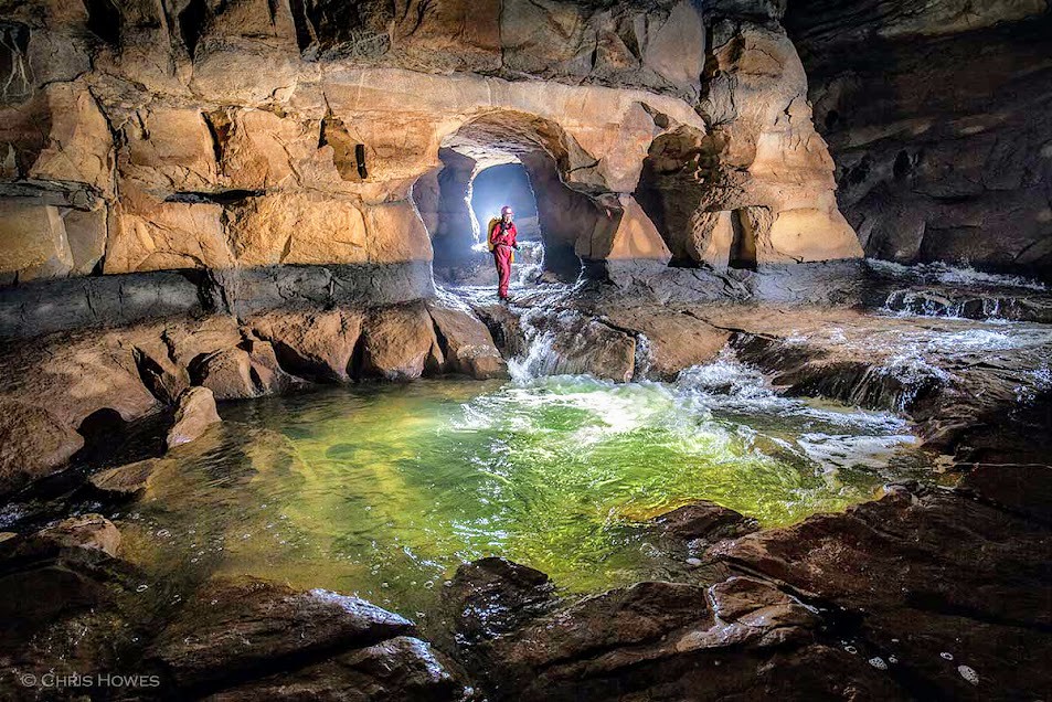
Caving at Meghalaya:
Meghalaya, known as the abode of clouds is dotted with hundreds of Caves and Caverns. Most of which are yet to be explored and some still to be discovered. Specially in the Jayantia and Garo Hills region of Meghalaya, the limestone caves that existed in the Earth since millions of years ago still depicts the master craftsman of the creator and patience of infinite time. It is the wonders in Darkness, it is the glory that nature can bestow. Visiting the ageold limestone Caves here in one will be experiencing the fascinating world of Darkness as if some unknown artist delineated the best ever works in and around...
Featured Circuits:
Guwahati - Shillong - Cherrapunjee - Shillong
Shillong - Cherrapunjee - Dawki - Mawlyngnong - Cherrapunjee
Shillong - Mawsynram - Shillong - Kaziranga - Dibrugarh
Shillong - Mawphlang - Sohra - Nartiang
Shillong - Jowai(for caving in different caves)
Guwahati - Dudhnoi - Tura - Baghmara - Balpakram
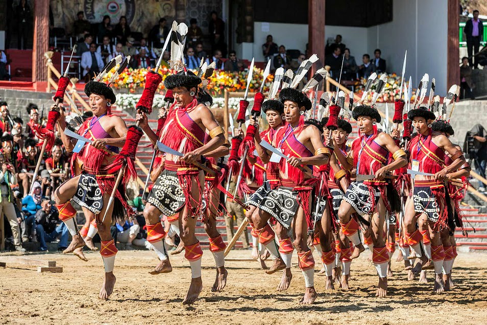
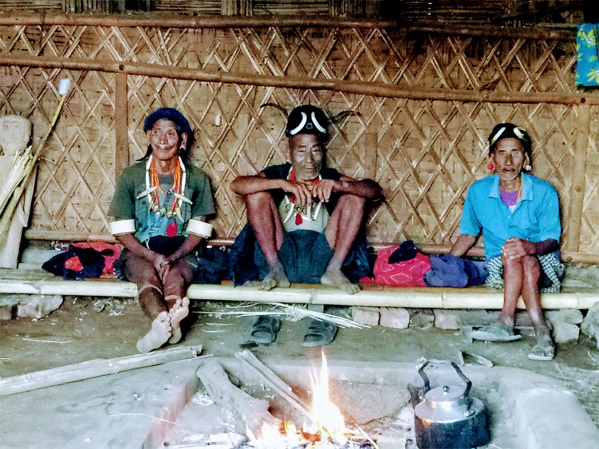
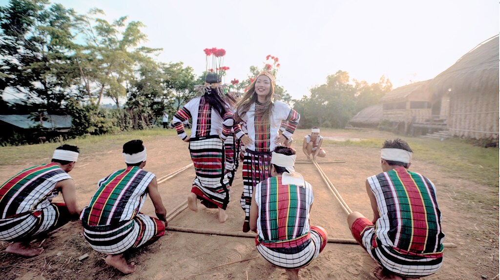
NAGALAND: Land of Naturally Appealing
Latitude: 25°06° N
Longitude: 93° 20° E
Time zone: IST (UTC +05.30)
Elevation: 490 feet to 6500 feet
Climate: Salubrious
Temp.: Summer 30 -15 celsius , Winter 15- 5 celsius
Area : 16,580 sq k.m.
Official Language: English, Nagamese
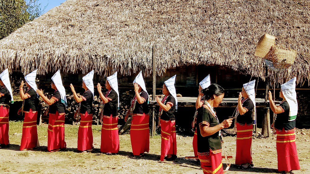
Community, Culture & Heritage
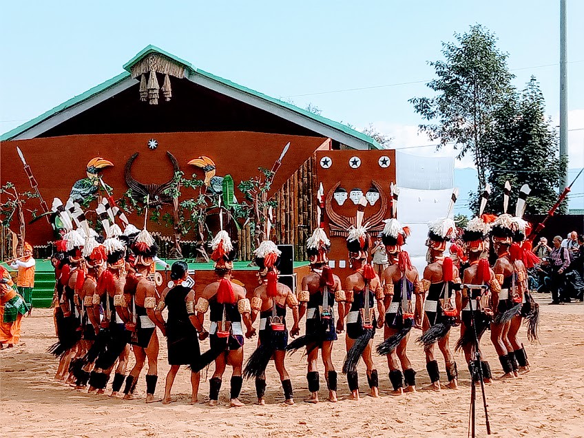
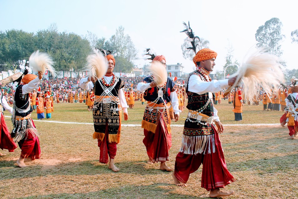
The age old culture, awesome traditions and magnificent heritage of the vibrant Naga Tribe of different communities.
Rural lifestyles of the Tribal Peoplewith beautiful ornaments & rich tradition of Naga attires, The much awaiting Hornbill festival- a conglomeration of Naga culture, tradition and heritages.
Cultural heritage of the Morungs-the bachelors’ dormitory signifying since long past as a centre of education, art&culture.
The must see memorial of the Second World War fame.
Eco and Nature:
The enchanting Khonoma village known for production of more than twenty varieties of rice & the terrace cultivation, the alluring Wokha , splendours of Mon-the border village Longwa inhabited by thebeautiful Konyak tribe and Mokokchang-the land of the spectacular Ao Naga tribe, the Kohima village known as theBara busti-the big village inhabited by the charming Angami tribe, mesmerizing Touphema are the names a few for the picturesque eco destinations in Nagaland.
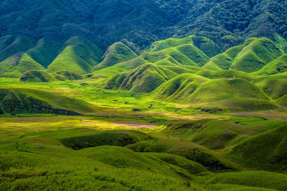
Dzukou and Japfu -Trekking and Adventurer:
The 3000 meter height above Japfu Peak-a heaven for trekkers, the mesmerizing Dzukou valley rich for eco diversity with varieties of floral species, especially for the tallest Rhododendron trees and awesome Dzukoy Lily, it’s a heaven for adventure tourists. Though adventurous, yet it has a scenic climb ever to memorize.
Featured Circuits:
Dimapur - Kohima - Khonoma - Juluki
Kohima - Dzukou - Japfu
Kohima - Wokha - Mokokchang - Mon - Logwah
Dibrugarh - Mon - Mokokchang - Touphema - Kohima - Dimapur
Guwahati - Kaziranga - Sibsagar - Mon - Dibrugarh
Dimapur - Kohima -Mon - Tuenchang
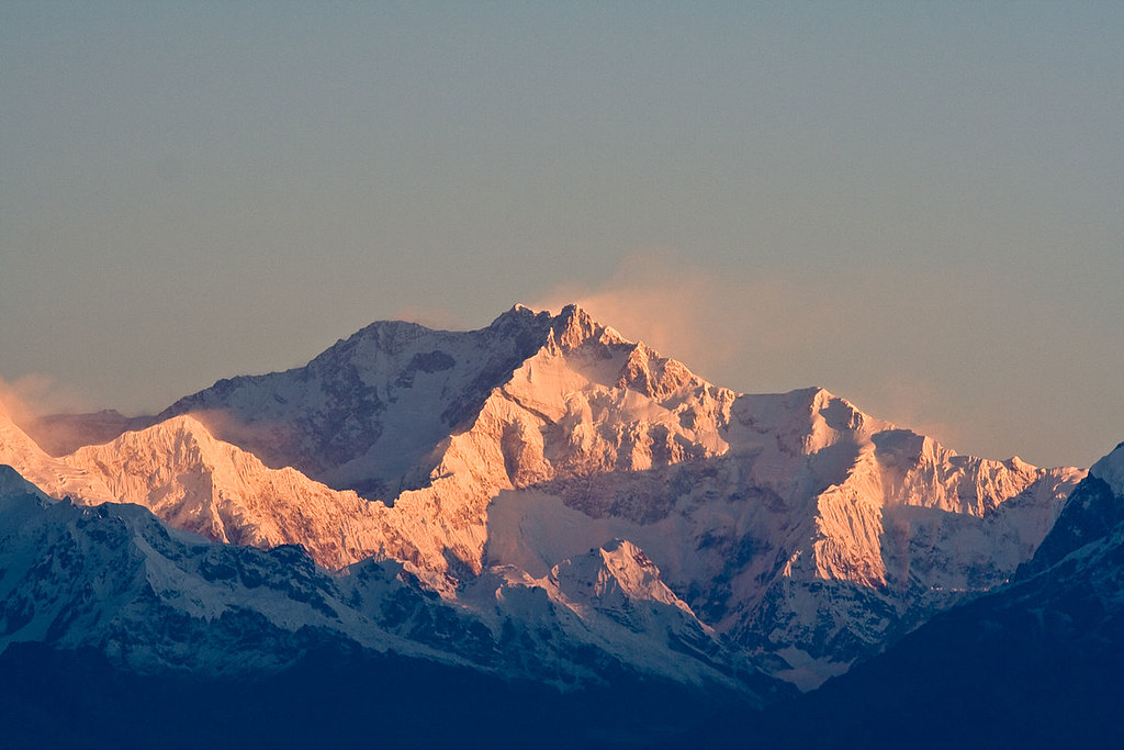
SIKKIM: Land of Organic Initiative

Latitude: 27.5330° N
Longitude: 88.5122° E
Time zone: IST (UTC +05.30)
Elevation: 920 feet to 28,169 feet
Climate: Temperate (sub-tropical in the southern, tundra in the northern range)
Temp.: Summer 28°-18°celsius,Winter 10°- -30°celsius (depending on elevation)
Area : 7,096 sq k.m.
Official Language: English, Nepali, Bhutia, Lepcha
Community, Culture & Heritage

Experience the Lepchas & Bhutias, visit to the Baba mandir, walk to Kartok & Sangey monastery, experience the Sikkimise cuisine, visit to Serendepity , Explore Lachung, Pelling ,Yumthang, experience in Temi Tea Garden
Eco and Nature:
Visit to Nathula pass, Jelepa psss, Menmecho lake, explore Jaluk –the paradise unexplored.awesome Tsomgo lake, View Khangchenjunga
Featured Circuits:
Gangtok - Tendong - Damthang - Temi
Gangtok - Mangan - Lachung - Yumthang
Gangtok - Chngthang - Lachen - Zemu glacier
Gangtok - Tsomgo - Pelling - Darjeeling - Kalimpong - Bagdogra
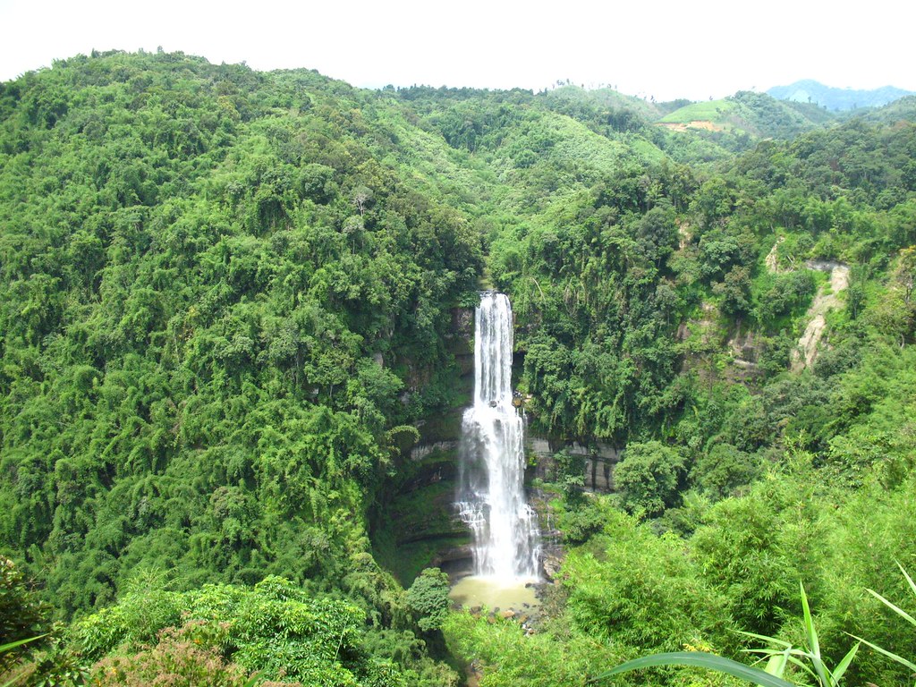
MIZORAM: Land of Grandeur & Beauty
Latitude: 23.1645° N
Longitude: 92.9376° E
Time zone: IST (UTC +05.30)
Elevation: 3,300 feet to 7,250 feet
Climate: Temperate
Temp.: Summer 20° - 30°celsius, Winter 5°- 20°celsius (depending on elevation)
Area : 21,087 sq k.m.
Official Language: English, Mizo, Kuki
Community, Culture & Heritage
Experience Chapchar kut & Thalfavang kut festival, visit Champhai & Chawngtlai villages, Explore Thenzawl, Teste of Mizo cuisine, know the handloom & handicrafts of Mizoram, know about the World’s largest family.
Eco and Nature:
Visit to mesmerizing Vantawang & Tuirihiau falls, sight seeing at Tam dil or Phawngpui Mountain, explore Murlen National Park or Vangchhia-a natural heritage site.
Featured Circuits:
Aizawl - Rejek - Champhai - Zokhawtar - Aizawl
Aizawl - Hmuifang - Thenzawl
Aizawl - Falkawan - Thenzawl - Vantawang - Tuihiau